Rye Valley History

Tag: Families

Molasses Tradition in Sugar Grove: A Generational Craft

Molasses Tradition in Sugar Grove: A Generational Craft

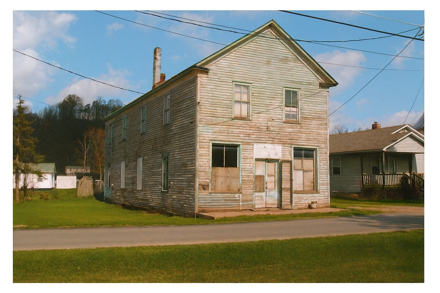
For generations in Sugar Grove, the Combs family  has carried forward a tradition that is as much about community and memory as it is about food. Making molasses was never a quick task or a solitary one — it was a season, a rhythm, and a ritual. Each step, from planting cane to sealing jars of molasses, reflects knowledge passed carefully and meticulously from one generation to the next. This is the story of how the Combs family makes molasses in the heart of Rye Valley, using tools, seeds, and methods that have endured for generations. Every batch of molasses begins long before the fire is lit under the pan. It begins in the cane patch — a field planted with seed saved from the previous year’s crop. This seed‑saving tradition is one of the most remarkable aspects of the process. Sherman Combs, Jr.  played a central role in this cycle. After the cane matured, he would walk the rows, selecting the best cane heads and carefully topping them in the harvesting process to collect seed. These seeds weren’t just agricultural material; they were heirlooms. Each year’s planting carried the genetics — and the memories — of many seasons and generations before it. This practice of “topping” the cane, gathering the heads, and saving seed ensured a consistent reliable crop, a lineage of cane adapted to Sugar Grove’s soil and climate and a direct connection between generations of farmers. Gayle Combs, the family patriarch, is shown in this photo going through the heads of the cane gathering the seeds to store for the next planting. Seeds can be stored for several years if kept dry and cool. They are usually stored in an old glass jug to prevent any moisture or other foreign matter from coming in contact with them assuring their quality. The jug has been around also for many generations.   Before any cane juice could be boiled, the custom molasses pan had to be prepared — a process that required both craftsmanship and patience. The pan is hand made and custom designed for the cane furnace using its specific measurements. The pan, typically a long, shallow metal trough, was fitted around a wooden frame. To ensure a tight seal, the pan was filled with water. As the wood absorbed moisture, it expanded, tightening around the joints and preventing leaks. Any small gaps or imperfections revealed during this stage were addressed before the pan ever touched the furnace and before any cane juice is put into it. This step is essential. A leaking pan could ruin hours of labor and waste precious cane juice. This preparation is treated as seriously as the cooking itself. The cane furnace — used not only for molasses but also for apple butter — is one of the most enduring pieces of family history. Built from stone and brick, it was designed to hold heat evenly and support the heavy molasses pan. The cane furnace is a rectangular structure built on top of the ground to form a box to contain the fire. it has a smokestack and slats across the top for added support of the pan when it is placed. The cane furnace sits under a pole shelter for added protection from weather and other elements. If it rains or is too windy, tarps can be added between poles for added protection from the weather. Before each use, the furnace has to be “mudded.” This means sealing the edges of the pan with a clay‑like mixture to prevent leaks, keep smoke and ash out of the molasses and ensure the pan heats evenly from end to end. This furnace isn’t just equipment; it is a landmark. Generations have gathered around it, stirring, skimming, talking, and working before first light until sunset. Once the cane furnace is properly made ready for the next molasses making event, the pan is placed carefully on fresh mud so that it forms a seal. Once the cane is harvested, the stalks are fed through a cane mill — a heavy, gear‑driven press that squeezes out the juice. The mill was often powered by hand, mule, or tractor, depending on the era. In modern times, a tractor is used to power the cane mill. As the stalks are crushed, the juice flows into a cloth strainer. This first filtration removed dirt, bits of cane plant matter, leaves and any other debris from the field. A fine, clean cloth sack is used for straining  for this step, ensuring the juice entering the pan from the cane mill was as pure and clean as possible. With the furnace hot and the pan sealed, the strained cane juice is poured in. This began the longest and most labor‑intensive part of the process: boiling the juice down into molasses. During this process, about half of the juice is lost to evaporation and skimming that renders a base product which becomes molasses. This stage could last many hours, often from early morning until sunset. Throughout the day, family and neighbors take turns feeding the fire, watching the boil, skimming and discarding skimmings into a nearby 5 gallon bucket. Skimmer tools are handmade from an old broom handles and metal that is hand crafted into a square scoop shape. the scoop has rows of holes so that liquid can flow through but the thicker foamy substance that rises to the surface does not pass through these holes and is discarded. These skimmers are used constantly throughout most of the process of making molasses. This process is performed along both sides of the pan for efficiency and turns are usually taken in the process by everyone. The color slowly deepens from pale green to a beautiful golden amber. The aroma — sweet, earthy, unmistakable — drifts across the yard permeating your clothes, your hair and any other material things you have while infusing everything with the scent of wood smoke mingled with molasses. It’s a unique scent only attained from this process. This…

Combs, Communities, Families, History, Sugar Grove

The Bank of Sugar Grove: A Brief Chapter in Local Enterprise

The Bank of Sugar Grove: A Brief Chapter in Local Enterprise

In the heart of Smyth County’s Rye Valley, the early 20th century brought a wave of local enterprise and ambition. Among the most notable ventures was the Bank of Sugar Grove, a short-lived but significant institution that reflected the community’s aspirations for economic growth and self-sufficiency The Bank of Sugar Grove was incorporated on October 2, 1914, with its principal office located in the Village of Sugar Grove, as recorded in Charter Book 2 at the Smyth County Courthouse. The bank’s stated purpose was broad and ambitious, encompassing the full spectrum of general banking activities: Discounting and negotiating bills of exchange, promissory notes, and drafts, Receiving deposits, Buying and selling exchange coin and bullion, Loaning money on real and personal collateral,Purchasing and selling stocks and bonds, This scope positioned the bank as a potential financial hub for local farmers, merchants, and residents seeking access to credit and investment opportunities. The bank’s capital stock was set between $10,000 and $25,000, with shares valued at $100 each. This structure reflected a modest but serious investment in the community’s financial infrastructure. Officers: R. N. Ward, President A. T. Slemp, Vice President L. L. Hutton, Secretary/Cashier Board of Directors: A. T. Slemp, Sugar Grove S. A. Meek, Sugar Grove R. N. Ward, Sugar Grove E. P. Wassum, Sugar Grove G. A. Lockhart, Rural Retreat L. H. Shumate, Rural Retreat J. S. Etter, Rural Retreat This blend of local and neighboring leadership suggests a regional vision for the bank’s role in Southwest Virginia’s economy. The bank operated from a building that once stood behind the current Sugar Grove post office. Though the structure no longer exists, its presence marked a tangible commitment to local commerce and financial independence. Despite its promising start, the Bank of Sugar Grove was dissolved on September 21, 1923. The reasons for its closure remain undocumented in the charter records, but its brief existence offers a glimpse into the challenges and hopes of rural banking in the early 1900s. While the Bank of Sugar Grove lasted less than a decade, its incorporation and operation reflect a pivotal moment in Sugar Grove’s development. It stands as a testament to the community’s entrepreneurial spirit and desire to shape its own economic future. Today, the memory of the bank lives on through courthouse records and local recollections, offering historians and residents alike a chance to reflect on the ambitions that once animated this quiet corner of Smyth County. The building later served as a meeting place for the International Order of Odd Fellows after it was used as a bank and also at one time had some apartments before falling into disrepair and eventually being torn down in the 90s.  It is estimated that this building was built in the 1920s according to some documentation but this is conflicting with the charter which states the bank was located in the community prior to this date. It stood through the mid 90s and is now an empty lot. During the time the building was being used, we know that Roy Fulton, a custodian who retired from Sugar Grove High School in 1953 , lived in one of these apartments where he made wood crafts and sold them to supplement his income during his later years. *Special thanks to County Administrator Shawn Utt and Clegg Williams for assisting in locating photos of this building. *Photo was colorized from original black and white photo dated 1997 for this article.

Bank, Business, Communities, Etter, Families, Lockhart, Meek, Odd Fellows, Organizations, Shumate, Slemp, Sugar Grove, Ward, Wassum

Dr. Goodridge Wilson On Our History

Dr. Goodridge Wilson On Our History

Early Settlers Were Attracted to Smyth County’s Rye Valley Rye Valley lies over the mountain to the south of Smyth County. State Route 16, the B. F. Buchanan Highway, coming from the north over Clinch, Brushy, and Walker mountains, passes through Hungry Mother Park, Marion, and Attaway, over another Brushy Mountain, and enters a locality where rye was growing in abundance when the first white men came to this region. That weed is smaller than the cultivated rye but resembles it, and is said to make fairly good horse and cattle food. The pioneers seemed to have liked the plant, perhaps because it grew so well here. Prior to or during the Revolutionary War they gave it its name not only the beautiful valley where the South Fork of Holston starts but also to Rye Bottom on Big Walker Creek, and to Rye Cove in Scott County. The valley is narrow. The high crosses it quickly at a little climbing the steep sides of Iron Mountain and on across Grayson County to North Carolina. The first pioneers who acquired land in Rye Valley appear to have been Joseph and Esther Crockett, enterprising land speculators, who were not husband and wife, but business associates whose names appear together on a number of documents. The late Squire Robert Ward of Sugar Grove, a descendant of one of them, showed me a deed dated in 1753 by which the king of England conveyed the land about the head springs of the South Fork of Holston to Joseph and Esther Crockett. Mr. Ward’s name was included in that grant. His grandfather, a Rev. Crockett, bought it from a James or a Nelson, Joseph and Esther Crockett, or their heirs, had sold the original tract to some families in Virginia and to Nelson families who came from Virginia and they became the first actual settlers in the iron region where three mountain brooks join their waters with those of a number of bold springs in level meadows to form the South Fork of Holston. Two of the brooks, Dickey’s Creek and Cress Creek, come out of Iron Mountain, and the third, Slemp Creek, tumbles into the valley from Brushy Mountain. In this valley meadows a forest of fine sugar maple trees grew. While I was living in Marion back in the 1920s and 30s I would go there sometimes to fish for trout, to visit in some homes, or to conduct a religious service in a public school. At that time two splendid groves, remnants of that ancient maple forest, provided wonderful picnic grounds and ideal places for all-day gatherings as Baptist Association meetings. They gave the community its name, Sugar Grove. Now the groves are gone, and much beauty formerly belonging to this place of many waters faded with the passing of those great trees. Perhaps the first permanent settler in Rye Valley was Jenkins Williams, who settled on land downstream from and immediately adjoining the original Joseph and Esther Crockett survey. When I lived in Marion his descendants in the seventh generation were living on that land. When I went to Marion one of them, a lad in knee pants, lived with his widowed mother across the street from me. He now lives in Richmond and is well known over the state as Robert Williams, executive secretary of the Virginia Education Association, a well-authenticated fact, who made his home here since 1754 when rescuers were trailing marauding Indians and found the dead body of Mrs. Samuel Stalnaker beside a creek, with her infant child crying “Hungry Manny,” they went to warn the family of a settler near the site of Sugar Grove, and left the child with that family. That settler may have been Jenkins Williams. In 1776 John Griffiths came from Pennsylvania and settled in Rye Valley. When I made a sightseeing tour in that section a few weeks ago, B.H. Griffiths of Marion went with me. He was born and grew up with his father’s name in a house that stands on the site of a log house in which the Griffiths settle of 1776 lived. Among other things he showed me some skillful doing masonry work and some lengths of old iron water piping, on a hillside above the South Fork of Holston. These are the remnants of a lead mining and smelting operation conducted there around the turn of the century. An iron working industry was started in Rye Valley early in the pioneer period. Jenkins Williams had a forge on the South Fork in which, among other items, he manufactured barrels for rifles used by Revolutionary War soldiers. A Pierce family engaged in iron working in the valley through successive generations. The Rev. Lewis Wetzel Pierce, a Methodist minister widely known throughout Southwest Virginia as a pastor of churches and as a former agent for the Children’s Home Society of Virginia, is now retired and lives in Bristol. He says that his great-grandfather, Moses Pierce, a Quaker, came from North Carolina and established   an iron   forge near the mouth of Comers Creek. His grandfather and his father were iron workers at Sugar Grove, He was born on inherited a farm located on the west side of Slemp Creek, which his grandfather bought from Jonathan Slemp. The Slemp’s, Frederick and Jonathan acquired land on the south side of Brushy Mountain in 1804. Mr. Pierce says that Jonathan’s land was on the west   side of the mountain between Crockett and Frederick’s on the east side. Frederick stayed and his descendants are still in that section. Jonathan sold his land to Alexander Wilson Pierce and his descendants, Col. Camp, who represented that area in Congress from the 9th Virginia District. The Brushy Mountain land is still called Slemp’s Creek.  

Communities, Crockett, Families, Genaology, Griffitts, History, History Keepers, James, Native American, Nelson, Pierce, Roberts, Stories, Sugar Grove, Teas, Ward, Williams

Stirring Tradition: The Art of Making Apple Butter

Stirring Tradition: The Art of Making Apple Butter

In the heart of Southwest Virginia, the quiet community of Sugar Grove, the Combs Family keeps a rich Autumn Appalachian tradition alive: the making of apple butter. This slow-cooked, spiced spread is more than just a seasonal delicacy—it’s a symbol of heritage, hard work, and togetherness of families and neighbors. For generations, churches, families and neighbors in Sugar Grove have gathered around copper kettles, often before dawn, to stir previously peeled and sliced apples over open wood fires, sharing stories and passing down techniques as old as the mountains themselves. Apple butter making in this region dates back to the early settlers who relied on preserving fruits to last through the harsh winters. What began as a necessity eventually became a celebrated tradition, with church groups, neighbors, visitors, and family farms organizing this activity each Fall. These events are part work, part festival, featuring laughter, music, and the comforting aroma of cinnamon and firewood filling the crisp mountain air. Today, making apple butter in Sugar Grove is as much about preserving a way of life as it is about preserving apples. Whether sold at local markets or ladled into jars for holiday gifts, each batch carries with it a sense of place and history that only Southwest Virginia can offer. What Does The Process Look Like? On a crisp October morning in Sugar Grove, Virginia, the valley hums with the low crackle of a hardwood fire and the rhythmic scrape of a wooden stirrer against copper. It’s apple butter day at the Combs family homeplace, and that means more than just cooking—it’s a gathering of generations, neighbors, and even curious visitors drawn by the promise of rich tradition and the sweet scent of spiced apples hanging in the cool and still misty, very early morning mountain air. The process is usually underway by 4AM. A pole structure, open on two sides and draped with a heavy tarp to block the wind on one, sometimes two sides, shelters the heart of the operation: a weathered “cane furnace” fueled by hand-split oak logs. The hardwood burns hot and steady, heating a gleaming copper kettle that’s been cleaned and set in place since before dawn. Within it, bushels of peeled apples—often Wolf River or another available locally grown variety—have been simmering for hours. The apples slowly break down, to the rich, deep brown of true Appalachian apple butter.. At the center of the kettle stands a stirring stick, worn smooth by decades of use and lovingly passed down by Grandad Combs. This stirrer has been passed down through the family, and today, a younger member of the Combs family keeps the rhythm going, arms steady as they guide the long handle around and around. “Don’t stop stirring,” someone calls out with a grin—one of many reminders passed along with the craft. What happens if you stop stirring? The copper kettle scorches on the bottom.  The kettle must be constantly stirred to prevent this costly mistake. Around the fire, a circle begins to form. camp chairs, cinder blocks, and a few other things provide makeshift seating as family and friends gather closer to stay warm. The picnic table is moved over near the cane furnace, Potatoes wrapped in foil roast slowly over heat nearby, filling the air with an earthy, comforting aroma. As the sun climbs higher, casseroles, crock pots, and dessert trays begin to appear on picnic tables—homemade dishes brought by neighbors and friends in true potluck fashion. There’s cornbread, slow-cooked beans, and pies of every kind. There are usually hot dogs to roast over the fire at the other end of the cane furnace as well.  It’s a feast earned by patience and fueled by fellowship. What Exactly Is This “Cane Furnace?” The cane furnace is a brick rectangular structure standing at a height of about 2 feet that we also use in the process of making molasses with a large rectangular pan. The brick foundation is mudded and provides a place to build a fire under the whole pan to cook cane juice all day. There is a smoke stack to carry smoke up through the roof and away from the work area. When we use this for apple butter making, we do not use the entire length of it and cover it except for a cut out that we have for the kettle so that we still get the use of the smoke stack and use the covered surface for baking potatoes and the fire for roasting hot dogs. Visitors Throughout the day, visitors drop by—some from nearby, others from out of state, drawn by memory or curiosity. They’re welcomed with a variety of food options, a chair, and often a story or two. Here in Sugar Grove, making apple butter isn’t just about the end product. It’s about the fire, the food, the stories, and the stirring—together. There is a LOT of stirring!  Over the years, we have hosted many guests, some were content creators who produced an entire documentary about Appalachian Life focusing on our apple butter making and others from as far away as New York! Our family’s old time apple butter making has been the subject of the Appalachian Studies curriculum at Radford University and has provided many with insight into the culture and heritage of Southwest Virginia’s people. Some of the lucky ones even get to take a jar or two home with them! The Day Continues… As the day wears on, the kettle’s contents darken and thicken, transforming from tart apple pulp into a silky, spiced spread with just the right balance of sweetness, spice and tang as cinnamon and sugar are gradually added. Every so often, several elder family members tests a small spoonful on a saucer, and nodding in quiet approval. “Almost there,” they say, the phrase echoing like a ritual. The patience is part of the process, part of what makes the end result so special. Rushing isn’t an option when it comes to good apple butter. Grandad, while he…

Combs, Communities, Families, History, Resources, Sugar Grove

From Sugar Grove To The American Red Cross National Capital Region

From Sugar Grove To The American Red Cross National Capital Region

Preface: This article will not be written by the editor of the site but rather its original author through the transcription of her original notes. The following comes to us from Janelle Hamric (1916-2022), a lifelong resident of Sugar Grove. Through her writings, we will now learn the full story of how Sugar Grove attained national recognition and played a notable role in the history of the country during WWI and then gained national recognition nearly one hundred years later. Donna (Hamm) Keesling’s Quilt    1918 “From the back roads of my mind…” Each Red Cross (small) joining the quilt represented a .10 cent donation. After the signing of “Armistice” on the eleventh hour of the eleventh day of the eleventh month 1918, the war which began in 1914 was over. Mama embroidered a “Gold Star” on any name of a serviceman’s square who had been lost in action. When my grandparents F. Jackson and Emma (Phipps) Hamm decided to sell their property at auction, including the mill they built, now known as the Hamm Roberts Mill, and move to Rising Sun, MD, chances were sold on the quilt at mama’s request and proceeds added to the Quilt Fund. Aunt Lora Hutton, her sister, had the lucky number! She said “I would like to let it go to the highest bidder.” Grandfather bought the quilt  and gave it to mama. Presently, I am the “Keeper” but it will be placed in the Smyth County Museum at a later date. Total amount collected for The Red Cross was $111.50 (In mama’s writing on the back of the quilt) The same buying power today would be $1868.65. My mother died at age 57 and we wondered what other things she could have done. She “loved her neighbors as herself” and was a dedicated Christian. I displayed the quilt for Elizabeth Church and the Ruritan Club November 4, 2013. Red Cross (Cont.) Mama thought the child who remained home the longest should have the quilt. My brother, Dean who lived in California had claim to the quilt. I kept it for several years and on his last visit here, I insisted he should take it with him. Two years ago, my brother realized his failing health and sent the quilt back to me UPS knowing it would find its rightful place in a museum. I am now the sole survivor of four siblings and “keeper” of the quilt. November 20. 2015 a letter was sent to Mrs. Hamric from the American Red Cross National Capital Region thanking her for her donation of her mother’s quilt. It went on to say “The quilt was on display at the Annual Salute to Service Gala in Washington DC. It served as the centerpiece in an exhibit celebrating the long history of support the American Red Cross has provided our men and women in the military. Over 700 guests were present for this event including US Secretary of Defense Ashton Carter.” This letter further went on to say that given the historical importance and age of the quilt, a textile expert had been engaged  from the Corcoran Gallery of Art  to ensure proper preservation of this quilt.  It also specified that it was believed that this quilt was part of a larger national fundraising effort for the war in 1918 and further research would be done for additional examples across the country.  Sugar Grove’s Red Cross quilt serves as the centerpiece for this exhibit.

Communities, Families, Hamm, History, Keesling, Mill, Sugar Grove, Teas, WWI

History of the Dickeys Knob Fire Tower

History of the Dickeys Knob Fire Tower

The Dickeys Knob lookout tower was built in the early 1930s. The exact date is unknown. A USGS marker is located on top of the mountain not far from the location of the lookout tower. 1934 has been said to be the year of the construction because a 1934 penny was embedded in the wet cement of the marker. Later, vandals chiseled it out. Seasonally, during Spring before the trees leafed out and Fall when lots of dry vegetation was on the ground were the times that guardians/fire watchers were employed to man the fire towers. They used a device that was rather modern for the time called an Osborn Fire Finder. This was used to determine the location of the fire so it could then be pinpointed on a map and reported. Reports were made to dispatchers using short wave radios or telephones that were maintained by the US Forest Service for this purpose. A report was needed from 3 total lookout towers to pinpoint coordinates on a map of a fire location. This all took place before fire crews were summoned. To use an Osborn Fire Finder, you needed to look through the sights similar to sights on a rifle, line it up with the base of the fire and a peephole in the rear sight.  Once the hair is properly aligned, you can then take the horizontal reading in degrees and minutes. After that,  you obtain the vertical angle reading by using the measurement on the sliding metal piece on the rear sight and estimate the miles between the tower and the sight of the smoke using the metal tape on the device.  Check the map which is calibrated to my tower’s location and affixed to the fire finder to pinpoint the area of a fire very closely. This fire finder was designed by W. B. Osborne, a US Forest Service employee in 1915. Parts for this device have not been produced since 1975 making them very scarce. There are also no casting patterns or production drawings.   Guardians, or lookouts lead a very quiet and often lonely existence in the lookout towers.  Sometimes people would climb the mountain to visit or bring supplies, food or water. During fire season, sleep was interrupted every hour on the hour during the night to scan the horizon for a glow of fire. Sometimes Steam from moonshine stills back in the mountains could be seen from the lookout towers but the fire watchers knew better than to report this due to the isolated nature of their work and reasonable possibility of severe retaliation from the moonshiners. The tower on Dickeys Knob was 50 feet tall and had an interior space of 12×12 enclosed at the top. There was a catwalk all the way around the top of the tower on the exterior. Generally, October 15-December 15 and February 15- June 15 is considered “fire season” by the US Forest Service in our area which is known as the Holston District of the Jefferson National Forest. During the time of these operations, Charlie Harrington, a Sugar Grove native, and 4 other men in this district, would make the fire towers their homes where they would live, eat, sleep and keep lookout for forest fires.  If someone seen smoke, they used the Osborne Fire Finder to get a coordinate/location then made contact with other towers in the area to have them do the same. With a total of 3 coordinates, the location would be pinpointed on a map and a fire would be reported to the ranger or assistant ranger on duty who would be on their way to the location with a fire crew. The Osborne Fire Finder was similar to a large compass laid overtop a map of the area. Two other towers were needed to provide coordinates to map an exact location. At this time, the US Forest Service had their own telephones and lines that they maintained. Workers were required to have a phone at their home and were assigned a specific number of rings such as 2 longs and 1 short. These phones were wall mounted crank phones. There were very few phones in Sugar Grove at this time. The public phone system during this period was called Inter-Mountain Telephone Company. The fire tower was equipped with a small wood stove for heat and cooking. There was also a 1 man bed, some cabinets for storage and cooking utensils. Among these were a few porcelain pots and pans which were widely used during this era.  The tower had unobstructed glass windows all around for a full 360 degree view of the forest.  The tower had no electricity or running water. Perishables could be hung underneath the tower on the north side to keep items cool. With the elevation, there would often be a nice breeze flowing and the north side provided shade from sun.  There were no restroom facilities except for a small brown building at the base of the tower a little ways off to the side which was an outhouse.       The fire tower was a popular place to visit in the 1930s and 1940s. At that time, it was possible to drive a car up to the tower or walk up the mountain trail. On the east side, there is a rock cliff with a drop some 30 feet straight down. After the tower was a torn down, a hiking trail was built from the nearby Raccoon campground. This trail goes past the cliff and then to the top of the mountain. Charles Harrington kept a guest log that Donald Harrington, his son, made available in his book*. The tower had lots of visitors who signed the log book. Sometimes they were from other states. When visitors came to the tower, Mr. Harrington gave them a “Squirrel Card” that featured a picture of the lookout tower and bore the emblem of the US Forest Service. It read “This Certifies that ______On…

Communities, Dickey, Harrington, Industry, Railroad, Sugar Grove

The Connection Between The Morgan Cemetery and Ridgelawn Cemetery

The Connection Between The Morgan Cemetery and Ridgelawn Cemetery

In the charming community of Teas, a very old and historic cemetery stands quietly on a hilltop, enveloped by the tranquil beauty of farmland and lush pastures. It silently surveys the small community from its elevated perch. If you’re not from the area, you might not even notice it, as it’s nestled away from the usual routes and seldom frequented these days. For those who know where to look, the taller gravestones rise against the distant horizon, meeting the skyline. Nestled off the beaten path, Morgan Cemetery is a hidden gem,  albeit somewhat challenging, location for those who wish to pay their respects. The cemetery, with its tranquil setting, might escape the notice of those who aren’t specifically searching for it. Yet, it holds a wealth of local history, serving as a final resting place for many early Teas, Sugar Grove and Rye Valley residents, including several members of the Calhoun family. (Article about the Morgan Cemetery coming soon.) Morgan Cemetery’s seclusion adds to its charm but also presents practical challenges. Its inaccessibility makes it a place that requires intention and effort to visit, which perhaps contributes to the depth of its historical significance for those who do make the journey. You can hike up the hill but beware of the bull. The best way up is a 4 wheel drive with the permission of the farmer. As the communities of Teas and Sugar Grove grew, so did the need for a more accessible cemetery. Enter Ridgelawn Cemetery—a project that came to fruition with the purchase of land from one of the Calhoun brothers, either Emory or Ellis (I’m not sure which at this time but will update when I get that information). This acquisition marked a significant shift, not just in terms of land ownership but in how the community would manage its historical and memorial locations. This new location provided much easier access to the burial sites of loved ones. This purchase took place sometime in the 50s along with the building of the new Wharf Hill UMC building.  There was a little known fact about the transaction of this land. It contained a small separate parcel located in the top corner where the Calhouns would make a family cemetery of their own which would later become part of Ridgelawn Cemetery. It is within this general area that our story focuses. Several graves in this area of the cemetery are of notable interest, including those of James Thompson Calhoun, , and George Washington Calhoun. These graves were originally part of the Morgan Cemetery before being relocated to Ridgelawn Cemetery by one of the Calhoun brothers for easier access and maintenance. As Ridgelawn Cemetery was established in the1950s, this section was incorporated into the larger cemetery and is now managed by Wharf Hill UMC. We have found death certificates for two of the relocated individuals that list their original interments as “Teas” and “Morgan.” Unfortunately, we were unable to locate information for the third grave. The gravestones, many of which are from the early 20th century, stand as poignant reminders of a bygone era. They bridge the gap between Morgan Cemetery’s historical significance and Ridgelawn Cemetery’s modern role. For visitors, this family plot at Ridgelawn offers a unique opportunity to reflect on the passage of time and the ways in which communities adapt while maintaining their historical roots. As you visit Ridgelawn Cemetery and stand before the Calhoun family plot, it’s important to consider the journey these stones have made. From the secluded, picturesque Morgan Cemetery atop the hill to their new home in a more accessible location, these gravestones serve as a physical manifestation of the family’s enduring presence and the community’s commitment to preserving its history. These stones are among the oldest in the Ridgelawn Cemetery. While Morgan Cemetery may be difficult to access, its hidden nature adds to its mystique and historical charm. It stands as a testament to the past, reflecting an earlier chapter of community history. Ridgelawn Cemetery, with its modern amenities and enhanced accessibility, offers a space where history and the present intersect, ensuring that all residents are honored and memorialized. In navigating these spaces, we connect with the stories and lives of those who came before us, bridging eras and maintaining a continuity that enriches our understanding of both local history and the evolving landscape of community memory. Cemeteries are a very important part of local histories across the planet and can serve as information sources for many purposes.  With this in mine, I was thrilled to find out that Elizabeth UMC recently took on care of the Morgan Cemetery which will most assuredly preserve it for many generations to come. If you would like to see the Morgan Cemetery on the horizon, stand with your back facing the mill and look straight across the way up on the ridge in the distance. You should see the tall Williams stone and a few others against the sky. (The Williams stone is the tall one on the left side of the featured image. ) Nancy Calhoun Contributed the following on this post: I understand that my great uncle, Ellis Calhoun, was instrumental in establishing Ridgelawn and in moving family graves. My grandfather, Emory Calhoun, was the oldest Calhoun brother in the family of James Thompson “Thomp” and Sarah Elizabeth “Sally” Blankenbeckler Calhoun. He moved to Oklahoma in 1909 with his wife, Sarah Cathrine “Kate” Scott and their newborn son, Howard Calhoun. He made yearly visits “home” and stayed involved in various matters, including church. My great uncle, Ted Calhoun, gave us a tour of the new cemetery when we visited in the 60s. He related how a younger brother died young and had a coffin with a glass top. When it was dug up for the move, a perfect little soldier was visible under the glass since he had been buried in a military uniform. As they watch, he turned to dust and disappeared. Calhoun Grave Marker which was relocated Death Certificate.,…

Calhoun, Cemeteries, Churches, Communities, Elizabeth UMC, Families, History, Methodist, Morgan, Mysteries, Ridgelawn, Stories, Sugar Grove, Teas, Uncategorized, Wharf Hill

Jenkin, Uriah, & Joseph Williams

Jenkin, Uriah, & Joseph Williams

Jenkin, Uriah, & Joseph Jenkin and Uriah were among the earliest white settlers in the Rye Valley of Montgomery County, Virginia. They established their home at the headwaters of the South Fork of the Holston River. Initially part of Fincastle County and then Washington County by 1775, the jurisdiction shifted to Montgomery County around 1785. Subsequently, the Rye Valley became Wythe County in 1790 and Smyth County in 1832. Jenkin, along with his brother Joseph and their families, settled in the Rye Valley near present-day Teas, Virginia. Documented in the “Record of Certificates of Commissioners of Washington and Montgomery Counties, 1767-1788,” Jinkin Williams claimed 400 acres in Washington County and 200 acres on Staileys Creek in 1775 and 1772, respectively. Jenkin’s presence is noted in the 1782 Washington County Tax List and subsequent Montgomery and Wythe County Tax Lists. He was listed as having 1 tithe, 5 horses, and 7 cattle. Notable entries include Jenkin Williams receiving a treasury warrant for 100 acres encompassing the falls of Stailey’s Creek in 1787 and subsequent assignments to Absalom Cox and Michael Branstrater. Further land transactions involving Jenkin Williams and other settlers were recorded in Wythe County Survey Books, including entries for Doctor Thomas Rustin in 1796 and Henry Vice in 1799. These transactions delineate the expansion of settlement in the region, particularly along the Holston River and Cripple Creek. References for Samuel Williams and a land grant can be found at Library of Virginia here. Several of the Williams family are buried in the historic Morgan Cemetery. ——- Williams, Samuel Jr. Land Grant 31 October 1826. N.p., 1826. Print.

Genaology, Williams Genaology